Mapmaking, or cartography, continues to be a critical aspect of innovative geospatial technologies at its most basic level. But to under geospatial technology in the future, it’s imperative to look back at the origins and history of maps and what is currently recognized as modern cartography.
Table of Contents:
Maps in the Ancient Times
It was in 1963 when one of the earliest recorded maps was discovered dating back to 6000 BC. However, the civilization of ancient Greeks helped in the development of cartography not just as a form of art but also as a science.
Back then, people studying geography acknowledged that the Earth was round, with some of them attempting to calculate the circumference of the planet. It was also during this time when the first ever real comprehensive world map came into existence.
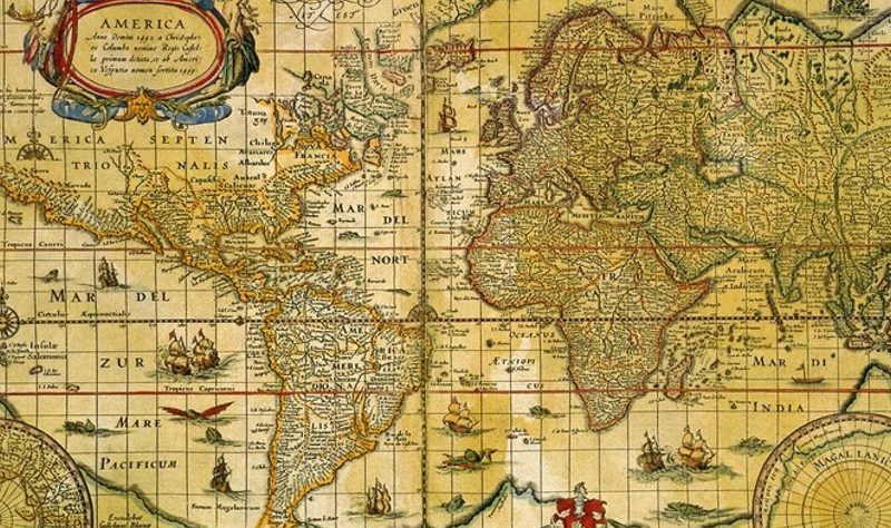
Ancient Roman cartographers relied on maps for their military needs as a tool for controlling their empire. The map of Ptolemy made around 150 AD paved the way for the Roman control’s further expansion. It was also among the first on record that referred to latitudinal and longitudinal lines which made a permanent impact on the practice of cartography.
Ptolemy’s map 150AD shows Pharan is no where near Mecca in Saudi Arabia
The Middle Ages Muslim cartographers depended heavily on the descriptions on Ptolemy’s map during their exploration of the growing Muslim world. Longitudes and latitudes dissected the world. These methodologies sparked the rise of cartography much further during the 16th century’s early modern age which marked the birth and evolution of printing.
Expansion and colonization of once unexplored lands resulted in the proliferation of printed maps for different regions of the world.
It was in 1569 when the most significant advancement in cartographic science took place when the first maps of Mercator were published. In 1570, his mapping methods improved further during the publication of Abraham Ortelius’ Theatrum Orbis Terrarum. For the very first time, it features maps according to the best available purely modern data.
Maps in the Modern Day
The demand for more complex and comprehensive maps also grew together with the increased global and trading commerce during the Industrial Revolution together with travel for leisure rather than business. Cartography and intelligence gathering were important for the many victories of the US forces in many military conflicts and wars.
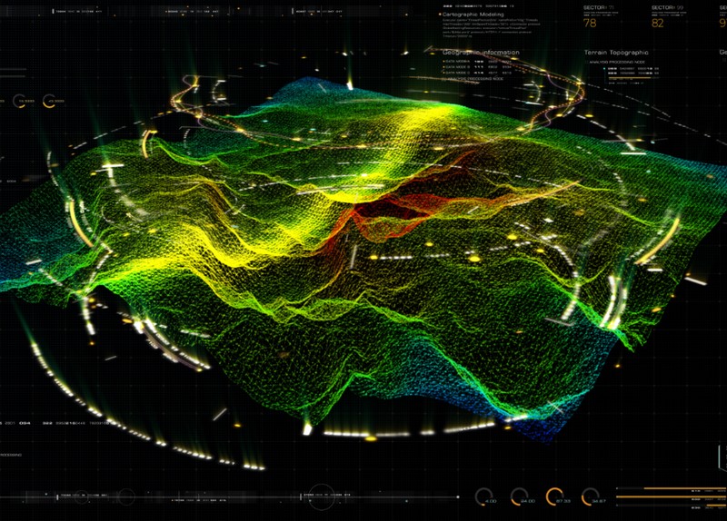
Technology invented and developed during the 20th century helped mould modern-day cartography. One invention was GPS which became accessible for mainstream consumers. This technology was soon integrated with light detection and radar or LiDAR technology.
LiDAR, which stands for Light Detection and Ranging, is a remote sensing method that uses light in the form of a pulsed laser to measure ranges (variable distances) to the Earth to make maps.
LiDar tech was initially meant for satellite tracking of atmospheric pollution and measured clouds as well as meteorology. It was during the latter part of the 1980s when LiDar data became more accurate with the commercial availability of GPS equipment.
Cartography in the modern day is an indispensable tool for geospatial experts. A good example of this is location analytics to track, prepare for, and recover from different natural disasters. Smart city decision-makers and urban planners rely on the data provided by modern tools for cartography to grow in such a way that offers community support.